TID’s continuously evolving Drought page is dedicated to providing timely updates through a multitude of resources that include updates on TID’s facilities in real-time, new developments and helpful links to keep our customers informed.
There are a myriad of definitions for the word “drought” however each end with the same conclusion, a lack of precipitation over an extended period of time, resulting in a water shortage. The significance of the word will also differ depending on how one is impacted by the outcome of a water shortage. For TID(Turlock Irrigation District) and our customers, the significance is great.
California has endured these periods of dry years before and TID recognizes that they are happening in greater frequency and for longer durations. TID has taken what we have learned from the last drought and prepared – through the development of tools and resources – to weather this dry season.
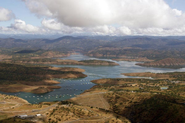
TID growers were resilient in making it through water reductions in each year of the 2012-2016 drought, the worst of which was a mere 18 inches of TID water available in 2015.
The 2021-2022 Water Year ended as 19th driest year on record for the Tuolumne River and the compounding effects of consecutive dry years place the 2020-2022 period as the third driest on record.
TID Board of Directors reduced the amount of water available to TID growers in 2020 and 2021 from the normal 48 inches to 42 and 34 inches, respectively. Then, for the 2022 Irrigation Season, reduced water availability further to 27 inches of water – nearly a 45 percent reduction from normal. Given the ongoing changes in climate, we know drought will come again and TID is taking steps to learn from previous droughts and applying advanced forecasting and modeling to make sure we protect the irrigation water our area depends on.
TID Board of Directors adopted a Drought Transfer Pilot Program (DTTP) at the beginning of the 2022 Irrigation Season. DTPP allows growers to transfer a portion or all available water, depending on water year type, on parcels they own or rent to another grower.
During the 2016 off-season, TID completed the Lateral 8 Regulating Reservoir Expansion Project nearly quadrupling the size of TID’s original seven-acre Lateral 8 pond built the previous year. The Lateral 8 Regulating Reservoir facility utilizes the entire 25.5 acre parcel on which it is located, increasing storage capacity from the original 29 acre-feet to 130 acre-feet. The Project supports water conservation by stabilizing flow rates in the system downstream of the reservoir and capturing water that is normally spilled allowing that water to remain stored in upstream reservoirs for later use.
The Sustainable Groundwater Management Act (SGMA) enables local agencies to manage groundwater locally so long as specific actions are taken and timelines met. SGMA required local agencies to form Groundwater Sustainability Agencies (GSAs) covering the entire Turlock Subbasin before July 2017. GSAs are required to develop and implement a Groundwater Sustainability Plan (GSP) or plans to achieve sustainability and prevent undesirable results.
The Turlock Subbasin’s local agencies eligible to form GSAs formed the West Turlock Subbasin Groundwater Sustainability Agency (West Turlock Subbasin GSA) and the East Turlock Subbasin Groundwater Sustainability Agency (East Turlock Subbasin GSA). The boundary separating the two GSAs is generally the Turlock Irrigation District’s eastern irrigation service area boundary. The GSAs submitted the necessary documentation to the Department of Water Resources (DWR) prior to the July 2017 deadline. The West Turlock Subbasin GSA (consisting of 12 public agencies) and the East Turlock Subbasin GSA (five agencies) are jointly developing a single GSP to manage groundwater sustainably through at least 2042.
The GSP is due to DWR before January 31, 2022.
The Airborne Snow Observatory (ASO) is an aerial snow monitoring tool that provides precise measurements of depth for every square meter of snow in the watershed. Combined with the conventional surveys, ASO provides a complete and near perfect picture of snow water content. No matter what type of hydrologic year California is experiencing – wet, normal, or dry – in addition to water supply and flood forecasting, ASO is useful for assessing many on the-ground conditions that support forest health, fire management and recreation.
TID last updated the Agricultural Water Management Plan (AWMP) in 2020. The AWMP provides a means to study how water is used within the District. It analyzes our water supplies, how they are managed and describes the irrigation system, pricing structure, canal operation, local cropping patterns and water demand, water supplies used over the years, and recharge. It highlights our conjunctive use program. It’s a way for the District to show how its programs and practices have helped to provide reliable water supplies to our growers, and how TID’s stewardship benefits the District’s customers and the region.
The AWMP is a good resource to better understand the District, its resources and facilities, and the programs, projects and practices that are used now and expected to be used in the future to meet local needs. A big part of the Plan is a water budget that includes all the inflows and outflows from the irrigation system. It also includes an analysis of a series of efficient water management practices, and what the District does with respect to each of the Enhanced Watershed Management Programs now and plans for the future. Also included is an analysis of climate change and drought management, impacts on the District’s supply and demand, and an adaptive approach to addressing the impacts expected.
Turlock Irrigation District (TID) officially implemented new features on their online water request system to benefit growers irrigating within TID’s service area. The new features allow growers to request water easily from a desktop, tablet, or mobile device. In addition to requesting water on the go, users can check the water usage on each parcel, view irrigation history, and download parcel summary reports. One of the most exciting features of the new water request website is the forecast tool, added on April 20, which allows users to plan their irrigation season by outlining irrigation dates and timing for the entire season. The forecasting tool will prove especially helpful in managing irrigations in dry years, like the one we are currently experiencing. You can watch the YouTube video by following the link below.
As part of TID’s conjunctive management program, the District is constantly looking for ways to enhance our surface water and groundwater interaction. A regulating reservoir supports water conservation by stabilizing flow rates in the system downstream of the reservoir and by capturing water that is normally spilled allowing that water to remain stored for later use. Stable flow rates and increased water supply reliability, coupled with faster response times to customer demands, provide vast improvements in customer service for growers served by the reservoir.
The Ceres Main regulating reservoir has a 175 acre foot capacity in which to capture flows from the Ceres Main Canal and then pump the stored water back into the Ceres Main Canal and the Lower Lateral 3 Canal. In addition to operational enhancements, the Ceres Main regulating reservoir will have the ability to reduce spills, reduce local groundwater pumping, and enhance deliveries downstream of the reservoir leading to improved irrigations services for our customers.
If you have questions or concerns regarding a domestic well, please call TID Water Distribution at (209) 883-8357.
In partnership with Turlock Irrigation District (TID), SRWA has identified the Tuolumne River as a surface water supply that can be used in conjunction with the Cities’ groundwater systems to provide a long-term, reliable drinking water supply for both Cities. The project to divert, treat and deliver drinking water to the Cities is known as the Regional Surface Water Supply Project ( RSWSP). This project provides a diversified regional water supply, allows for drought water management, improves water quality, and helps to replenish groundwater supplies. The Project is currently in the design and construction phases and is scheduled to be delivering water to the Cities in mid-2023.
 Turlock Groundwater
Stanislaus County Groundwater Resources Page
Stanislaus County Report a Well Problem Form
City of Turlock – Report Water Waste
City of Ceres – Report Water Waste
Association of California Water Agencies
California Farm Bureau
California Farm Water Coalition
Water Education Foundation
Save Our Water
Turlock Groundwater
Stanislaus County Groundwater Resources Page
Stanislaus County Report a Well Problem Form
City of Turlock – Report Water Waste
City of Ceres – Report Water Waste
Association of California Water Agencies
California Farm Bureau
California Farm Water Coalition
Water Education Foundation
Save Our Water
